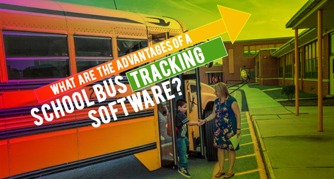
What Are The Advantages Of A School Bus Tracking Software?

School bus transportation has seen tremendous technological advancement over the last few years. Today, software is available for the school bus fleet management, including scheduling, and also geographic information system to improve efficiency and tracking.

The main purpose of employing technology in school bus fleet management is to ensure student safety. This is because these systems enable route planning to improve efficiency and provide information in real-time on location and security threats.

SCHOOL-TRANSPORRT-APP

Here are some of the key benefits that schools can enjoy using school bus scheduling software:

Improve Fleet Optimization

Manual scheduling of routes and times is a static procedure and it is one-dimensional in nature. Inconsistent school bus schedules tend to impact morning routines and results in frustrated parents calling the school for an update on arrival at the waiting point.

Inconsistency in tracking also leads to increased expenses. On the other hand, the use of right software helps schools easily overcome all these challenges.

Tracking software helps to analyze the bell times for students in different grades and tier the bus routes accordingly so that the late arrival of buses, calls from parents, and unnecessary spending can be avoided.

Tiering enables schools to use the same drivers and buses and this effectively reduces the requirement of buses and drivers by 50%. This, in turn, results in a reduction in overall transportation costs as well.

It is not easy to create effective tiered routes for school buses. Many scenarios have to be taken into consideration. However, the scheduling software allows for the creation of unlimited scenarios and study or review a number of hypothetical tiering schedules to ensure the optimal use of the school’s fleet of buses.

Makes Routing Easy

If the conditions remain ideal, schools can set the routes and use them every year. However, the reality is that the student population keeps expanding and costs continue to rise.

This means that school administrators must keep track of the routes and change them as required. Optimization of bus routes is the best way to reduce costs, minimize ride times, and ensure student safety.

This is best achieved by implementing the bus scheduling software. It may sound intimidating initially, but technological advances enable scheduling of school bus routes easy.

The software helps the school administration department to quickly analyze traffic pattern, route times, and student populations to ensure student safety.

The software also incorporates other functionalities. They make it possible for administrators to communicate with drivers and monitor the movement of school vehicles in real time.

When schedules need to be changed, school administrators will have to often put away other jobs and focus only on readjusting schedules.

The use of the bus scheduling software totally eliminates this problem. This is because the suitability of various alternative routes can be checked almost instantaneously, resulting in saving time and cost.

Update Drivers Quickly

Students move to new homes, and therefore, their pick up points change. The parents of a child may have split custody. The child may come to school by one bus but go back home on a different bus.

This child may also use different buses. In such cases, school bus drivers of respective routes should be informed of the same at the very next moment.

When the pickup point of a student changes, web access portals come to the aid of school bus drivers. The scheduling software provides drivers with daily updates before they start their work in the morning.

Reduce Costs

All schools experience problems with respect to balancing their budgets. When they face financial challenges, the first department to get the cut is the transportation department.

Parents become concerned when routes are changed and bus stops are eliminated. Fortunately, the scheduling software helps to optimize routes without compromising the safety of students.

The software helps to save money in the following ways:

Route Planning

School bus tracking software does away with the need to organize lengthy planning sessions. The routing job used to be completed only over a few days.

With this  software, the job can now be completed in a matter of minutes. It also has special features  which help to set parameters and designate zones when creating routes that are safe and efficient.

Maximizing Efficiency

Efficient routes reduce the fuel requirement and driver downtime. School bus scheduling and tracking software helps to identify the routes that rationalize the stops.

It also enhances student safety as it identifies routes that avoid areas with a high level of traffic. Rationalization of the routes also helps to minimize driver and bus requirement.

Integration

Advanced school bus scheduling software is available now and can be integrated with many other tools such as GPS systems.

These integrations, in turn, enhance the capability of the school bus scheduling software and help develop more efficient routes, identify inconsistencies, and track ridership. Elimination of inconsistencies further leads to a reduction in wasteful expenditure.

Conclusion

Investing in school bus tracking software often tends to save money in many indirect ways as well. For instance, the use of safer and more efficient routes helps schools to cut down insurance costs. When the software is integrated with tracking programs, reporting becomes much easier and this adds to the cost benefits.
The Amazing Evolutional Story of GPS Tracking

To figure out their position on earth and navigate, people once depended on different ways that are quite unimaginable in this digital era. It must be astonishing for today’s generation to imagine that mariners relied on methods ranging from angular measurements to positioning of celestial bodies for calculating their location. Radionavigation was the first ever modern technique used in order to calculate the exact location.

GPS was initially prepared for military purpose, and then its service was extended to various fields. GPS has proved itself to be one among the smartest inventions ever made. Now GPS has found its way to even school buses for better service and safety.

The extent to which it is provides service to customers is indeed appreciable.

Read on through the remarkable evolution of GPS:

1957: SPUTNIK, the first man-made satellite was launched. William Guier and George Waeiffenbach, American Physicist monitored the emission of radio transmissions from Sputnik with the help of which they could locate its orbit and location.

1959: The first satellite navigation system was built by Navy, which was named TRANSIT. It was built in order to obtain the exact location of submarines. The system was introduced with six satellites which eventually grew to ten. The subs had to wait for hours to receive signals from satellites. The model paved way for the true GPS with continuous signalling from satellites in space.

1960: TRANSITwas successfully tested

1963: The Aerospace Corporation completed a study for the military that proposed a system of space satellites which sends signals continuously to receivers on the ground and could locate vehicles moving rapidly across the earth’s surface or in the air. The study laid out the GPS concept for the first time. Receivers in vehicles on the ground would derive a precise set of location coordinates by measuring the transmission times of radio signals from satellites.

1974: After having worked on GPS for past 11 years, the branches of military launched the first satellite called NAVSTAR.

1978-1985: In order to test the NAVSTAR System, military launched 11 more test satellites in to space, which was called “the GPS system”. To measure the transmission time, the satellites carried atomic clocks with them. Sensor design to detect the launch or detonation of nuclear devices was carried by some of the satellites starting from 1850.

1983: Korean Airflight 007 was shot down by Russians after it wandered in the Soviet airspace over the Kamchatka Peninsula. All 269 passengers and crew members were killed. In order to avoid similar situations in future, President Reagan ordered that all civilian commercials aircrafts must be equipped with GPS system. He believed that GPS could help in navigation and improve air safety to a great extent.

1985: Contracts for “airborne, shipboard and man-pack (portable)” GPS receivers were given to private companies by Government.

1989: The fully operational GPS satellite was launched by the Air Force after testing for years. After the Challenger disaster in 1986, the plan to launch the satellite on the Space Shuttle was changed. It was used in a Delta II rocket instead.

1990: Defence Department deliberately decreased the accuracy of the GPS system fearing that military adversaries might use GPS system for their advantage.

1994: With an eye on the future, FAA and Bill Clinton granted the worldwide airline industry to continue using the GPS system for free.

2000: The purposeful degradation of GPS which was implemented before the first Gulf War by the Defence Department was stopped. Overnight, GPS became ten times more accurate and powerful. Industries like fishing to forestry to freight management began to use it.

2001: Private companies began to introduce out personal GPS products as the GPS receiver technology got smaller and cheaper. In-car navigation devices from Tom Tom and Garvin were introduced.

2004: A new technology was introduced known as “assisted GPS”, which has been tested and developed. The new eminent technology allows phones to use cellular signal in combination with GPS signal in order to locate the user to within feet of their actual location.

2005: “Block II”, first new generation of GPS satellite was launched from Cape Canaveral. Signals were transmitted by the new breed on a second, dedicated civilian channel.

2009: The Government Accountability Office (GAO) issued a report warning that the $5.8 billion effort to upgrade the GPS satellites was so fraught with technical problems, cost overruns, and delays that some of the satellites could begin to fail in 2010.

2010-2011: Two new GPS satellites was launched by Air Force,  one in 2010 and one in 2011 which are meant to keep the constellation operable, until the next generation “Block III” satellites get launched in 2014. An additional civilian GPS signal as well as enhanced performance compared to the GPS service is expected from new Block III satellites.

2012:Air Force manages a constellation of 31 operational GPS satellites, plus three decommissioned satellites that can be reactivated if needed, at present. The constellation ensures the availability of at least 24 GPS satellites, 95% of the time. The next addition to the constellation, the GPS IIF-3 satellite will be launched on October 4 by the Air Force in to the space.

How Does GPS Vehicle Tracking Systems Work?

GPS were initially used for military purposes by the US Department of Defense. But nowadays its commercialization has opened up a new window of opportunities in the field of safety and security. Everyone with a hand held mobile device can be powered with a GPS tracking app. This has made it possible to track assets on the move. Together with an embedded RFID card (with the asset), ensuring safety and security has become easier and economical. It is this cost effectiveness and the ease of use that has made GPS tracking systems widely accepted.

What is GPS?

Before understanding how a GPS tracking system works, let’s find out what is GPS. GPS or Global positioning systems is a satellite based technology that helps to track precise location of vehicles, person or other assets and also to provide data at regular intervals. A GPS tracking system can collect data in the asset’s environment and relay the same to a remote server, where the data can be further analyzed. GPS coupled with an RFID tag can be very useful. An RFID uses radio frequency of short range to relay data.

Now, let’s see how it works.

            As mentioned before, GPS is a satellite based technology which uses a Global Navigation Satellite System (GNSS) network. It uses a microwave signal which is sent to the GPS device. It gives provision for both real-time and historical data recording. This is made possible by the 27 GPS satellites orbiting the earth, in a time span of 12 hours. Of these 27 satellites 24 are currently operational and the rest 3 are reserved for when the others fail.

The device carrying a GPS system comprises of a GPS module which receives the signals and is also responsible for calculating the co-ordinates. Based on function, GPS trackers can be of three types – Data logger, Data pusher or Data puller.

Data logger: It is basically used to log the position of a device at regular intervals. It uses an internal memory to store data.  It also comes with a memory card slot or internal flash memory and USB ports. The data from the device can only be moved to a computer for further analysis once data recording is complete as it can only be used for logging purposes.

Data Pusher:The GPS system which schools and fleet companies use these days belongs to the category of data pushers. Besides this, it can also be used for asset tracking and personal tracking. A data pusher records data like speed, altitude etc. and pushes them to a server where the further analysis of these data can be done.

When used for tracking school buses, text messages are sent to a mobile phone that has a GPS tracking app installed, in the event of school bus arrival or the student boarding the bus, via SMS or GPRS. It can also transmit location and telemetry input data or when an event takes place like a door open/close or geo-fence border crossing or engine ON/OFF.

Data puller: In this a remote system sends an SMS to get information from a GPS device. It is similar to a data pusher but the difference is that the data from the GPS system is sent only when it is requested by the remote server. It requires internet and GPSD only occasionally. These systems are used in situations where a constant source of energy is unavailable.

Why use GPS?

  • Not only does it allow data recording and transmission, but it does this in real-time. It is highly accurate and gives a precise location of your assets.
  • Buses follow pre-defined optimized routes set by school authorities, which reduces fuel consumption and also travel time. Hence, it is becoming more popular with schools and fleet companies.
  • It has helped to reduce pollution since the buses take the shortest routes possible and are well maintained.
  • Helps to monitor the school bus driver’s driving pattern.

RFID is another technology, which along with GPS improves asset or personal tracking. The radio frequency it sends out can be used to transmit information using the GPS system. Student ID cards using RFID’s embedded on them can be used while entering or exiting buses. The information thus generated can be sent to parents via a GPS connection therefore informing the parents whether the student has boarded the bus or not.

Parents Happy With the Installation of GPS in School Buses

Parents won’t always be free to take their child to school and take them back to home. Therefore, they have to depend on school buses to send their children to school. Almost all the schools now provide this transportation facility; either bus or some other vehicles. But all parents are concerned with the safety of their children. How can you ensure the safety of your child in their way to school? Global Positioning System (GPS) will help you to ensure the security.

Soon, the Government will make it mandatory for all school managements to install global positioning system (GPS) in school transport vehicles and parents are quite happy with this decision. Many schools already have GPS systems with tracking and monitoring system with equal involvement of parents and management.

With the increase in number of assault cases against children in school hours, parents are much worried about their safety. With the installation of GPS tracking system in the school buses, parents and school authorities can be sure of the travel route of the students and they will be informed in case any untoward incident takes place.

Advantages of GPS Tracking System

• Real- time information
Undoubtedly, one of the most advantageous features of GPS Tracking System is real-time information that one received about the location of the school bus. It helps you to know where the buses are, monitor pick up and drop off. You will be informed if any bus goes in a wrong route or if there is any unscheduled stop or delay.

• Student safety
Get notified if a student gets into a wrong bus or steps out at a wrong station. Even if the student misses his/her station, the parent will be informed. The exact location of the child can be identified with RFID tags attached to the devices.

• Monitoring the speed, managing the route and scheduling
If the vehicle is moving at a high speed, you will be informed and you can warn the school authorities to control it to avoid accidents. The authority can rely upon RFID school management software. The software can do routing and scheduling automatically. In that way, time and energy needed for rescheduling and re-routing can be saved.

• A solid record
It is possible for the school authorities to record all the activities and route of the school bus using the GPS tracking system.

What is there to worry?

The number of children abducted on their way to school and to home is increasing rapidly. Majority of the kidnapped children were found dead or had been missing. This is a dangerous situation. You cannot always have your children by your side. So finding a reliable solution to this is a necessity.
Edsys’ School bus Tracking System is a reliable solution to tackle this problem effectively. This will make parents really happy because it is so easy to use and syncs with the Parent Portal.

Once installed in your smart device having internet connection Parent Portal gives the following information:

• The travel history of their child at any given time
• A confirmation whether their children has reached school or home
• Monitor speed of school bus
• Time duration at each stop
• The reasons of delay such as break down, traffic jams, natural hazards etc.

Notifications can be enabled as per needs. For example, few minutes before the bus reaches in the morning, when the student boards the bus, when the student misses the bus or when the student reaches home etc.
The installation of GPS tracking systems with RFID software will surely reduce the number of crimes and attacks against students. Even if a child is abducted, it makes it easy for the authority to find the missing child with minimum time. Since the safety of the child is the major concern, the installation of a GPS tracker will make the parents really happy.

GPS School Bus Tracking System – How Effective It Can Be?

Are you imagining dangerous scenarios once your child's school bus is a little late? It is quite natural. But it would be easier if there was a work around. It is said that there is a solution for all the issues in the world. This issue is solvable too.

Implementing a GPS based tracking system to track school buses is an effective solution to your concern regarding your child's safety. school Bus Tracking is effective because it:

Addresses Safety Concerns

With school bus tracking in place, it is time for the parents to quit worrying whether their child has reached school safely. School Bus Tracking provides real-time updates to parents and school authorities about the student's location using RFID tags and GPS.

Considering its simplicity and utility, this vehicle tracking system is a boon for school authorities as well as parents. Notifications are sent for unscheduled stops, and the real time location can be checked from the system's mobile application; thus quickly finding solutions during emergency situations.

Makes Managing

The RFID school management system would be of great use to school authorities. The software does the routing and scheduling automatically, thus conserving time and energy needed for re-routing and re-scheduling in case of any issues.

Improves Efficiency & Savings

Routing and planning manually can sometimes lead to errors, thereby causing waste of energy, time and money. Having an RFID vehicle management system in place can help in tackling such errors.

By having the RFID vehicle management system, it is possible to calculate the distance covered by the school bus, the fuel consumption etc. Also, you'll be able to analyse the school bus drivers' performance.

Acts as a Solid Record

It is possible for the school authorities to create a record of the activities of each bus of a school by using a GPS vehicle tracking system. Also, if the bus takes a wrong route or if the student has boarded the wrong bus or if he/she goes missing, the parents and school authorities will be notified in a short period of time, helping them to track the student immediately.

The RFID school management system is surely a way to ease the tensions of the parents and the school authorities regarding the whereabouts of students.

Due to the effectiveness and the benefits, the Vehicle Tracking System is on the rise in Dubai these days. To lessen the worries regarding students' safety concerns, it's time for your schools, as well, to start implementing the system.